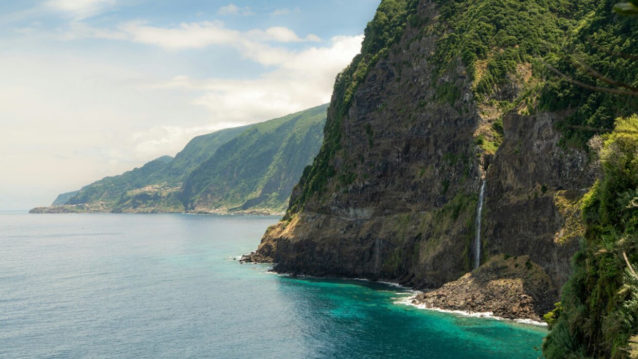
There is a version of Madeira that appears on every travel magazine cover, in every Instagram feed, in every airline seat-back screen. Cabo Girao from the glass skywalk. The levada path through the laurel forest. Funchal bay from a hotel terrace at golden hour. These places are on those lists because they are genuinely extraordinary. They are also, at peak season, shared with several hundred other people who found the same article you did.
Then there is the other Madeira. The waterfall that falls 140 metres into a green cauldron and requires a ten-minute walk from a small car park that has no signage visible from the main road. The black sand beach backed by volcanic cliffs on the northwest coast that most north-coast drivers pass without slowing down. The viewpoint behind a small cemetery in a village no tour bus has ever stopped in, that gives you one of the most peaceful panoramas on the island in total silence. The plateau above the clouds at 1,580 metres where the valley below disappears entirely and you are, for a few minutes, standing on the roof of something extraordinary.
This is that Madeira. Eight places, none of them on the standard itinerary, all of them worth a rental car and a morning.
1. Garganta Funda waterfall, Ponta do Pargo
West coast, approximately 1 hour 20 minutes from Funchal · 10-minute walk from roadside parking
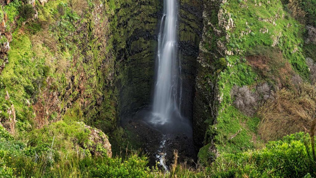
The name translates, with appropriate drama, as Deep Throat. Garganta Funda is a waterfall of approximately 140 metres, one of the tallest on the island, that drops from the cliffs of the Ponta do Pargo plateau in the island’s far southwest, visible not from below but from above, from a natural viewpoint where the full height of the cascade is visible as it falls into a green volcanic cauldron far below.
Most waterfalls are viewed from the bottom. Garganta Funda is viewed from the side and above, which changes the experience entirely, the scale reads differently when you are level with the top of the fall and looking down the full length of it, with the Atlantic visible beyond the cauldron as it meets the coast below. It is one of the great hidden viewpoints on the island.
The access road is narrow and the parking area is small and easily missed if you are not specifically looking for it. In summer the waterfall can reduce to a trickle if rainfall has been scarce, visit a day or two after rain for the full cascade. In winter and spring it runs at full volume and the surrounding vegetation is intensely green.
Getting there: drive to Ponta do Pargo on the ER101 road, then follow signs toward the lighthouse (Farol de Ponta do Pargo). The waterfall access point is on a small road south of the lighthouse. No formal signage at the main road, look for the small track on the left approximately 500 metres before the lighthouse. Parking is roadside, space for around four cars.
2. Praia Ilhéus Ribeira da Janela, northwest coast
Northwest coast, 20 minutes east of Porto Moniz
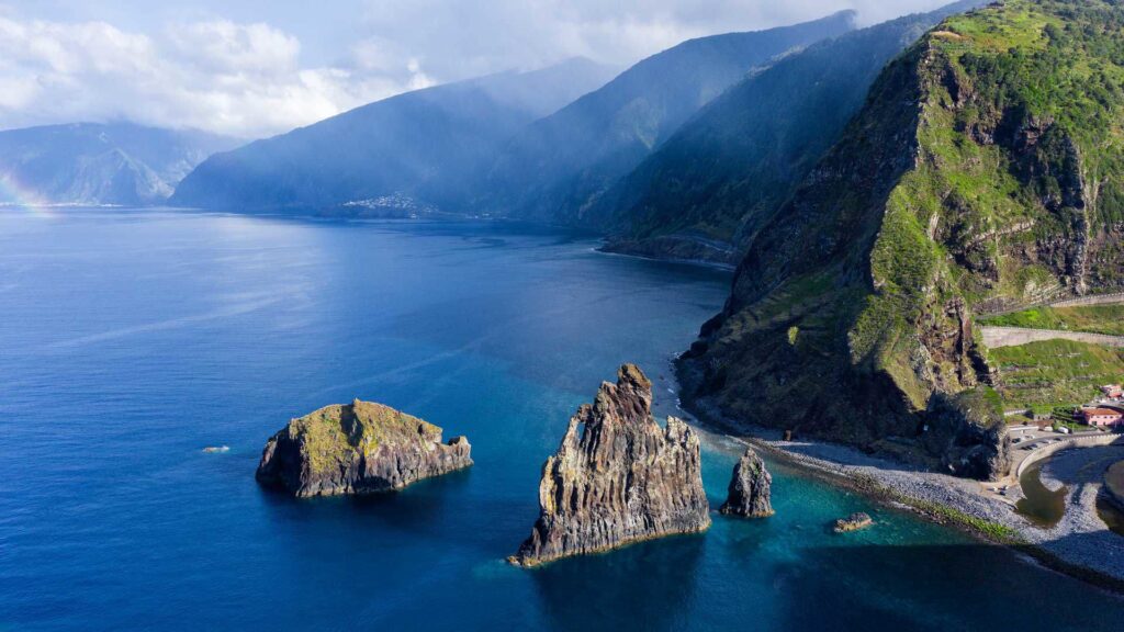
Most visitors driving the north coast road from Seixal to Porto Moniz are focused on the destination ahead, the famous lava pools, the seafood restaurants, the coastal drama of the northwest corner. Almost none of them stop at the small track that leads down to Praia Ilhéus Ribeira da Janela, a pebbled beach backed by towering volcanic cliffs and fronted by dramatic sea stacks rising from the Atlantic, one of the most striking natural compositions on the island’s coastline.
The beach itself is not for swimming in typical Atlantic swell conditions, and it is not the point. The point is the sea stacks, the ilhéus (small islands) that give the beach its name, and the scale of the cliff faces behind it, and the quality of light that hits the northwest coast in the afternoon when the sun is dropping toward the Atlantic and everything turns warm and gold in a way that the south coast, facing away from the sunset, never does.
There is a small natural tunnel in the rock behind the beach that some visitors know about and most do not. At low tide, with appropriate footwear, it is passable.
Getting there: on the EN101 coastal road between Seixal and Ribeira da Janela village, look for a small parking area on the seaward side approximately 2 kilometres west of Ribeira da Janela. A short track leads down to the beach. No facilities.
3. Bica da Cana plateau, central mountains
Central mountain interior, approximately 45 minutes from Funchal
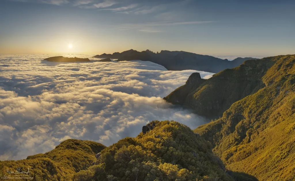
Madeira’s mountains generate their own weather, and the phenomenon most worth chasing is the temperature inversion, when warm, moist Atlantic air meets the cold mountain peaks and settles as cloud at a consistent altitude, leaving everything above it in brilliant sunshine while the valleys and the coast below disappear entirely under white.
The Bica da Cana plateau, at 1,580 metres in the central massif, is the most consistently reliable place on the island to be above the cloud layer when inversion conditions occur. From the viewpoint above the plateau, the valley of Sao Vicente disappears entirely into white cloud below, the surrounding mountain peaks rise from it like islands in a white sea, and the silence, genuine alpine silence, with no road noise, no wind, nothing is total.
The road to Bica da Cana from Funchal passes through the Paul da Serra plateau, a high moorland of extraordinary emptiness that feels nothing like the rest of Madeira, before climbing to the viewpoint. The descent toward Sao Vicente on the far side, on a road that drops through cloud into the green north coast valley below, is one of the finest drives on the island.
Getting there: drive the VE3 expressway from Funchal toward Ribeira Brava, then take the ER228 up through the Encumeada pass and across the Paul da Serra plateau. Bica da Cana viewpoint is signposted from the main plateau road. Best visited in early morning when inversion conditions are most likely.
4. Faja dos Padres, south coast
South coast, 30 minutes west of Funchal · cable car access only
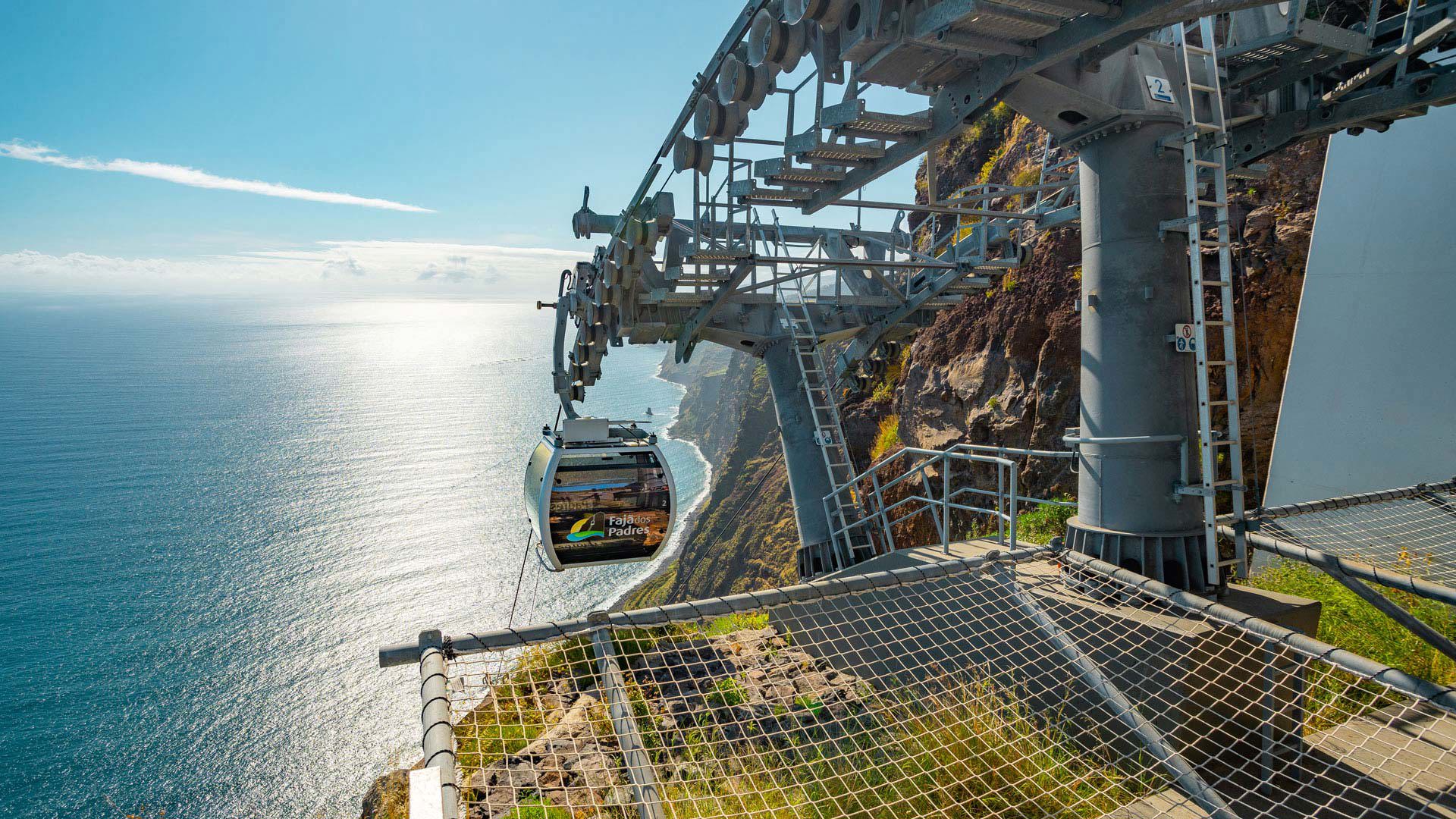
Faja dos Padres is not a secret in the conventional sense, it has its own cable car, its own restaurant, its own small collection of beach cottages available to rent overnight. But it is accessible only by that cable car, which descends 300 metres down a vertical cliff face, and the effort required to reach it, combined with its exclusion from standard day tour itineraries, means that the small pebble beach at the bottom receives a fraction of the visitors of comparable south coast locations.
The faja itself, a Portuguese word for the narrow strip of flat land at the base of a sea cliff, created historically by rockfall, is one of the last places on the island where the traditional Madeiran malvasia grape variety is grown, in small terraced plots between the cliff base and the sea. The wine produced here is available only at the restaurant above the beach, which serves grilled fish and traditional Madeiran dishes with the cliff face rising vertically behind you and the Atlantic immediately in front.
The overnight stay option, small cottages at the base of the cliff, with the sound of the sea and the cable car silent after the last evening descent, is the most isolated accommodation experience available on the island’s south coast. Book well ahead.
Getting there: the Faja dos Padres cable car departs from the EN101 road between Funchal and Ribeira Brava, near the village of Campanario. The cable car operates seasonally, check current opening hours before planning a specific visit. The descent takes approximately three minutes.
5. Miradouro de Sao Roque do Faial, northeast coast
Northeast coast, approximately 50 minutes from Funchal
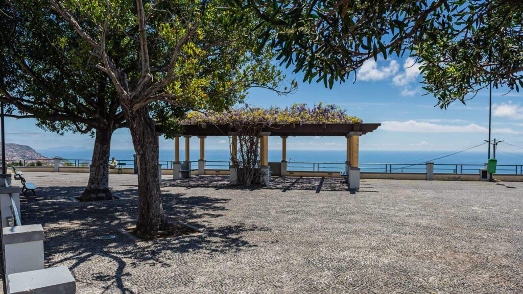
A viewpoint behind a small cemetery in the village of Sao Roque do Faial that appeared on no travel website until recently and still receives almost no international visitors. What it offers: one of the most peaceful panoramas on the island, looking east across the Faial valley toward the distinctive volcanic plug of Penha de Aguia (Eagle Rock) rising from the coast, with the terraced hillsides of the northeast corner visible in every direction and, at the right time of year, the entire landscape turned golden by afternoon light.
The cemetery itself, small and immaculately maintained in the Portuguese tradition, sits at the viewpoint’s edge. The combination of the view, the silence, and the sense of finding something the standard itinerary entirely missed makes this one of the more genuinely affecting stops on the island for a certain kind of traveller.
There is no car park. There are no facilities. There is no sign pointing to it from the village. You park on the road, walk through the cemetery gate, and arrive at the viewpoint. Nobody else is there.
Getting there: drive to Sao Roque do Faial on the northeast coast road. In the village, look for the small cemetery on the hillside above. Access is on foot from the road, the cemetery gate is usually open.
6. Praia da Laje, southwest coast
Southwest coast, approximately 1 hour from Funchal
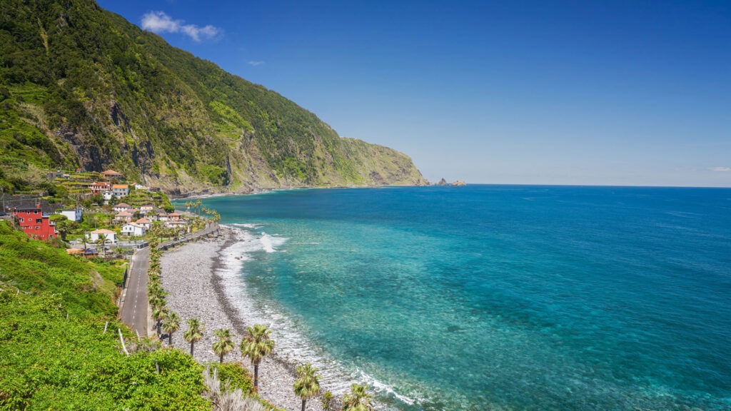
Madeira has very few beaches by European island standards, and the ones it has are largely volcanic pebble rather than sand. Praia da Laje, on the island’s less-visited southwest coast near the village of Jardim do Mar, is one of the finest, a striking beach of dark volcanic sand creating a visual contrast with the turquoise Atlantic and the green cliffs that frame it that is unlike anything available on the south coast near Funchal.
The village of Jardim do Mar immediately above the beach is one of the most authentic remaining fishing villages on the island’s south coast, small, genuinely local in character, with a clifftop promenade and a handful of restaurants that serve the catch from the boats moored below. The surf here, when the Atlantic swell is running from the west, can be significant, Jardim do Mar is one of the better known surfing spots among the small community of surfers who visit the island.
For non-surfers, the combination of the dark beach, the village above it, and the absence of tourist infrastructure makes Jardim do Mar one of the more honest encounters with what Madeira’s coastal communities looked like before the clifftop hotel era.
Getting there: drive the EN101 west from Funchal past Ribeira Brava and Ponta do Sol, then take the road down to Jardim do Mar. The village road is narrow, drive slowly. Limited parking above the beach.
7. Caminho da Entrosa, north coast
North coast, between Arco de Sao Jorge and Boaventura · 3-4 hours one-way
One of the most genuinely under-the-radar hiking trails on the island, and arguably one of the finest walks in Madeira for travellers who have already done the classified PR trails and are looking for something beyond the booking portal.
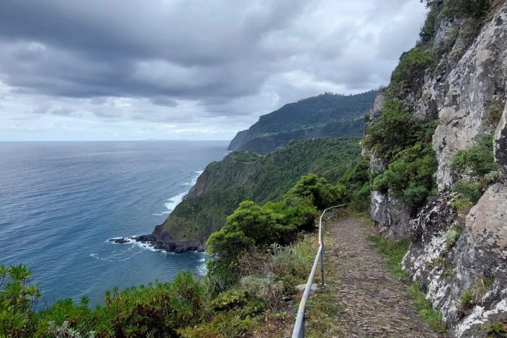
The Caminho da Entrosa runs from Arco de Sao Jorge on the north coast to the village of Boaventura, following a ridge trail above the northern coastline with views that alternate between the Atlantic below and the island’s central peaks above. It is not a levada walk, there is significant elevation gain and loss, and the path is less clearly marked than the PR trail network. A map downloaded in advance and moderate navigational confidence are the appropriate preparation.
The reward is a level of solitude and an angle on the north coast landscape that the classified trail network, increasingly busy with advance-booked visitors, no longer consistently delivers. On a clear morning in autumn, with the coast visible in both directions and the island’s peaks behind you, it is exceptional.
Getting there: start in Arco de Sao Jorge on the EN101 north coast road. Download the route on AllTrails or Wikiloc before departing, signal is unreliable on the ridge section. Not classified as a PR trail and therefore not subject to the SIMplifica booking requirement.
8. Miradouro de Terra Grande, central mountains
Central mountain interior, on the road between Bica da Cana and Ribeira Brava
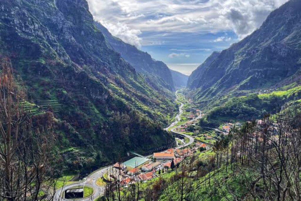
The viewpoint that most consistently provokes the reaction “why is this not in every guide to Madeira?” The Miradouro de Terra Grande sits on one of the most beautiful mountain roads on the island, the descent from the Bica da Cana plateau toward the south coast, and offers a 180-degree panorama over multiple valleys simultaneously, with the mountain ridges descending in layers toward the south coast and the sea visible on the horizon.
What makes it different from the island’s more celebrated viewpoints, Cabo Girao, Pico do Arieiro, is the direction of the view. Where those look outward to the ocean, Terra Grande looks inward across the island itself, revealing the extraordinary complexity of its volcanic topography, the deep valleys, the ridgelines, the terraced agriculture still visible at lower altitudes, in a single composition that no other single viewpoint on the island provides.
It is on a road most visitors have no reason to take unless they are crossing between the Paul da Serra plateau and the south coast, which is exactly why almost nobody stops here. Stop here.
Getting there: on the ER228 road between the Paul da Serra plateau and Ribeira Brava, approximately 8 kilometres below the plateau junction. Look for the small miradouro sign on the left side of the road on the descent. Parking for approximately six cars.
How to use this list
Every location on this list requires a rental car. None is reachable by public transport in any practical sense, and several involve roads that require the ability to reverse confidently on narrow mountain tracks when two vehicles meet.
Madeira’s roads reward patience. The mountain and north coast roads are narrow, steep, and frequently single-track with passing places. They are also some of the finest driving roads in the Atlantic islands, the scenery visible from the car between these locations is, in many sections, as good as the destinations themselves.
The best approach is to combine two or three locations from this list into a single day, planned around the geography rather than the distance. Garganta Funda and Praia Ilhéus Ribeira da Janela share the northwest coast and work naturally together. Bica da Cana and Miradouro de Terra Grande are on the same road. Caminho da Entrosa and Miradouro de Sao Roque do Faial are both on the northeast coast.
Build the day around the drive as much as the destination. In Madeira, that is always the right instinct.
Getting around Madeira is easier with your own wheels. Search rentals here:
A note on “secret” places
Nothing on this list is genuinely undiscovered. Every location here appears somewhere on the internet, is known to local guides, and will become busier as Madeira’s tourism continues to grow. The more responsibly useful framing is: these are places that the standard tour bus itinerary does not include, that the majority of first-time visitors to the island will not reach, and that reward the traveller with a rental car and a willingness to follow a road to see where it ends.
Treat them accordingly. Park considerately on the narrow roads. Take your litter. If you find a place that clearly has not yet been discovered by the volume of visitors that would damage it, the correct response is to enjoy it quietly rather than to immediately post the coordinates.
The other Madeira exists because most people do not look for it. The looking is most of the point.
The rest of the Madeira series
Everything you need to go properly:
- Madeira: the complete guide – what it is, where it is, how to plan a week or two weeks from scratch
- Madeira’s levada walks – every trail worth doing, the 2026 SIMplifica booking system explained, what to pack
- Eating in Madeira – espada, lapas, bolo do caco, Michelin restaurants, where to drink poncha properly
- Where to stay in Madeira – from Reid’s Palace to a north coast wellness retreat
- The best tours and activities in Madeira – whale watching, jeep safaris, catamaran sunsets and the Pico do Arieiro sunrise that changes how you think about early mornings
- Why Madeira is the most underrated island in Europe – the editorial case for why this island belongs at the top of every serious traveller’s list
Ready to go? Search flights to Madeira below: