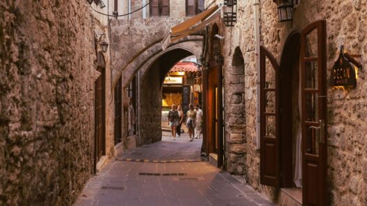

There is a pattern in the Okinawa archipelago that every serious traveller eventually discovers. The main island is extraordinary. The Kerama Islands, 40 kilometres west of Naha, are better. Miyako, 300 kilometres further southwest, are better still. The Yaeyama group, at the far southwestern edge of the archipelago, delivers experiences that require an entirely different vocabulary. And Yonaguni, the last inhabited island before Taiwan, sits at the end of all of it, closer to Taipei than to Tokyo, home to underwater stone formations that may be the ruins of a civilisation that existed before recorded history, or may be the most extraordinary natural rock formation on earth. Nobody is entirely sure which. Both possibilities are compelling.
The outer islands of Okinawa reward the traveller willing to take an additional flight, book an additional ferry, spend an additional night. The main island gives you the heritage, the food, the cultural depth of the Ryukyu Kingdom. The outer islands give you the water, the wilderness, the silence, and in the case of Yonaguni, a mystery that has not been resolved in forty years of research and probably will not be resolved in your lifetime.
This is the guide to going further.
The Kerama Islands
Access: High-speed ferry from Naha Tomari Port to Zamami (50-70 minutes), Tokashiki (35 minutes), or Aka (50 minutes). Day trips are possible but overnight stays transform the experience.
The Kerama Islands National Park, designated in 2014, covers a cluster of 22 islands 40 kilometres southwest of Naha, four of them inhabited, the rest uninhabited coral and rock rising from one of the finest marine environments in Japan. The water here is called Kerama Blue by the divers and marine researchers who use it as a benchmark for clarity, a transparency produced by the absence of river sediment from the small, geologically simple islands, and by the clean currents of the East China Sea, that delivers visibility of 40 metres on a good day and a colour from above that has no adequate name in English.
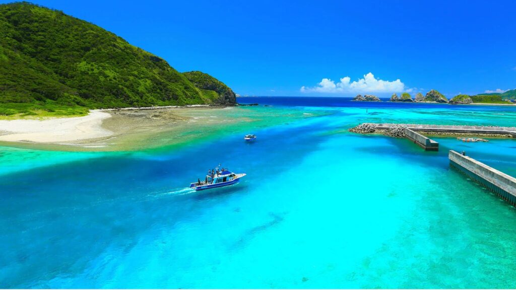
The Kerama Islands hold over 60 percent of Japan’s reef-building coral. Furuzamami Beach on Zamami Island is a two-star Michelin Green Guide site, the only beach in Okinawa to hold this designation. The humpback whales that migrate through the Kerama channel between January and March have been studied by marine biologists for decades and are among the best-documented cetacean populations in Japanese waters.
Zamami Island
The most visited and the most complete visitor experience in the Keramas. Zamami village is small, quiet, and genuine, a working fishing community that has accommodated visitors without becoming oriented around them. Two beaches define the island: Furuzamami on the southern coast, long and shelving and fringed by reef beginning almost at the waterline, and Ama Beach on the northern side, smaller and often quieter than Furuzamami on peak summer days.

The snorkelling at Furuzamami is the finest accessible without a boat in the entire Kerama group. Sea turtles are resident in the reef system and encountered with a reliability that reflects the health of the ecosystem rather than careful management for tourism. In January to March, the whale watching from Zamami is among the finest available from any island in Japan, the humpbacks use the Kerama channel for breeding, and the combination of a small boat, a marine guide, and the sound of a humpback breathing across the water before it dives is one of those encounters that requires no embellishment.
The ferry from Naha’s Tomari Port runs several times daily on the high-speed Queen Zamami service (50 to 70 minutes). The slow ferry takes 90 minutes but carries bicycles, which are the correct way to explore the island’s roads.
Tokashiki Island
The largest of the inhabited Kerama islands and the least visited relative to its size, which makes it the better choice for travellers who want the Kerama experience with fewer day-trippers on the beach. Aharen Beach on the western coast and Tokashiku Beach on the eastern side offer different experiences of the same island: Aharen sheltered, reef-accessible, backed by a small cluster of guesthouses and the island’s main restaurants; Tokashiku more exposed, quieter, and facing the Pacific rather than the calmer waters of the Kerama channel.

The snorkelling between Aharen Beach and the small islands offshore, accessible by kayak rented at the beach for approximately 1,500 yen per hour, covers reef terrain of the same quality as Furuzamami in conditions that are often less crowded. The high-speed Tokashiki ferry from Tomari Port takes 35 minutes, shorter than the journey to Zamami, which has contributed to its relative undervisitation.
Aka and Geruma Islands
Connected by a footbridge to each other and separated from Zamami by a short boat crossing, Aka and Geruma are the quietest and most intimate of the inhabited Kerama islands. The accommodation options are fewer, the facilities more basic, and the experience proportionally more genuine. Sea turtles nest on the beaches here under minimal disturbance. The diving accessible from both islands covers reef of the same Kerama Blue quality as Zamami and Tokashiki with considerably fewer other divers present.
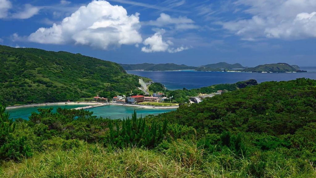
For the traveller whose instinct is always to take the quieter option, Aka is the Kerama answer.
Miyako Island
Access: 45-minute flight from Naha. Also reachable by ferry (approximately 5 hours) or by direct flight from Tokyo, Osaka, and Nagoya.
Miyako Island sits 300 kilometres southwest of Naha in water so clear it barely looks real. The island is flat coral limestone, no rivers, no mountains, almost no topographic drama, and the geological consequence of this is that nothing muddies the sea. The Miyako Blue is a distinct phenomenon from the Kerama Blue: paler, more translucent, so transparent that the coral and sand bottom is visible at depths that would be opaque anywhere else. The finest expression of it is Yonaha Maehama Beach on the southwest coast, seven kilometres of powder-white sand with this water in front of it. It is the most beautiful beach in Japan by most serious assessments and one of the finest in Asia.
Three bridges extend from Miyako’s main island to neighbouring islands, Irabu Bridge (3.5 kilometres, the longest toll-free bridge in Japan) to Irabu Island, Ikema Bridge to Ikema Island in the north, and Kurima Bridge to Kurima Island at the southern end of Maehama Beach. Each bridge is a destination in its own right for the views it provides over the water below, and the islands at the far end of each offer beach and reef experiences slightly quieter than the main island.
Yonaha Maehama Beach
Seven kilometres of white sand on Miyako’s southwest coast, facing west for sunsets of extraordinary quality. The water is the defining feature, the Miyako Blue in its most direct expression, flat and pale and so clear that the sandy bottom reads almost phosphorescent in afternoon light. The beach shelves gently, is safe for swimming across a wide range of conditions, and is backed by a small number of hotels and beach bars that maintain the atmosphere without overwhelming the setting.
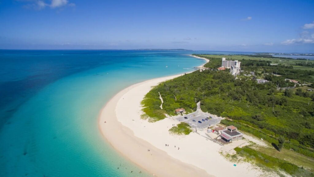
Kurima Bridge is visible at the southern end of the beach, and Kurima Island beyond it, accessible by bicycle from the beach, has water of even greater clarity and far fewer visitors than Maehama itself. The thirty-minute bicycle ride across the bridge and around the island’s coastline is the finest cycling available in the Miyako group.
Sunayama Beach
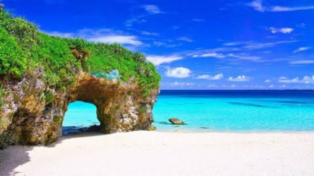
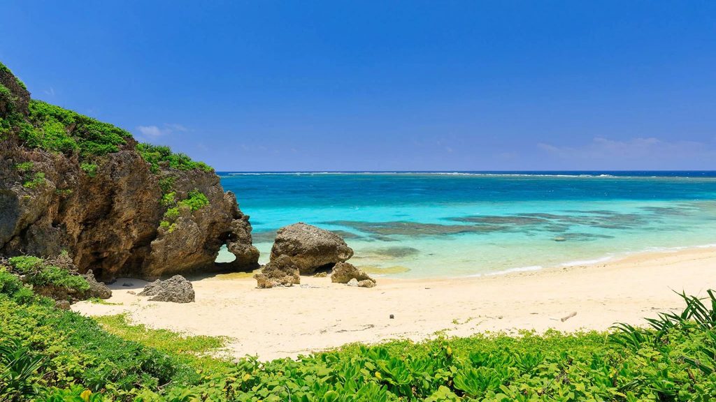
Twenty minutes north of the main resort area by rental car, Sunayama Beach is accessed by climbing a sand dune, suna yama means sand mountain, and descending to a beach framed by a natural limestone arch that frames the Miyako Blue in a composition that has made this one of the most photographed natural formations in the archipelago.

The arch is large enough to walk through at low tide. The beach beneath it is coarser than Maehama but the water quality is comparable and the crowd level is consistently lower.
Ikema Island
Connected to the north end of Miyako by bridge, Ikema is a small island with a mangrove wetland on its northern coast, one of the few intact mangrove systems in the Miyako group, accessible by kayak from a launch point near the bridge, and a habitat for birds and marine life unavailable on the open beaches of the main island.
The contrast between the tropical colours of Miyako’s reef beaches and the quieter, greener character of the Ikema wetland makes the combination one of the better half-day alternatives to another beach visit.
Irabu Island and diving
Connected to Miyako by the 3.5-kilometre Irabu Bridge, Irabu Island has the finest diving available in the Miyako group and is home to Iraph Sui, the Luxury Collection hotel covered in the where to stay post. The dive site Mao no Kyuden on Irabu’s northwestern coast, a series of submarine limestone caves and arches at depth, is considered among the finest cave diving in Japan for intermediate and experienced divers.

The tuna drift dives in the Miyako channel, where large schools of yellowfin tuna are encountered in the current, are available through Irabu dive operators and have a following among serious divers who travel specifically for them.
Still need a hotel for Okinawa? Browse options on the interactive map below.
The Yaeyama Islands
Access: 55-minute flight from Naha to Ishigaki. Day trips to Taketomi (10 minutes by ferry), Iriomote (35-45 minutes by ferry from Ishigaki), and Yonaguni (75-minute flight from Naha or 4.5-hour ferry from Ishigaki).
The Yaeyama Islands are the most remote, the most diverse, and in many ways the most extraordinary cluster of islands in the Okinawa archipelago. Ishigaki is the hub, a full-sized island with its own airport, its own infrastructure, and its own considerable attractions, but the islands accessible by short ferry from Ishigaki’s port extend the experience into territory that has no equivalent elsewhere in Japan.
The Yaeyama language, distinct from Okinawan and from Japanese, with its own grammar and its own music tradition, is still spoken in communities across the group. The sanshin music of the Yaeyamas has a different character from that of the main island. Taketomi is the most complete surviving Ryukyuan village in the archipelago. Iriomote is UNESCO World Natural Heritage. Yonaguni is Japan’s westernmost point, closer to Taiwan than to the rest of Japan, with hammerhead sharks and a mystery on the ocean floor.
Ishigaki Island
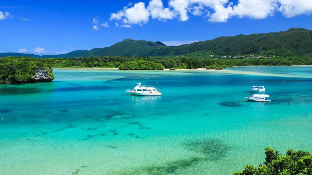
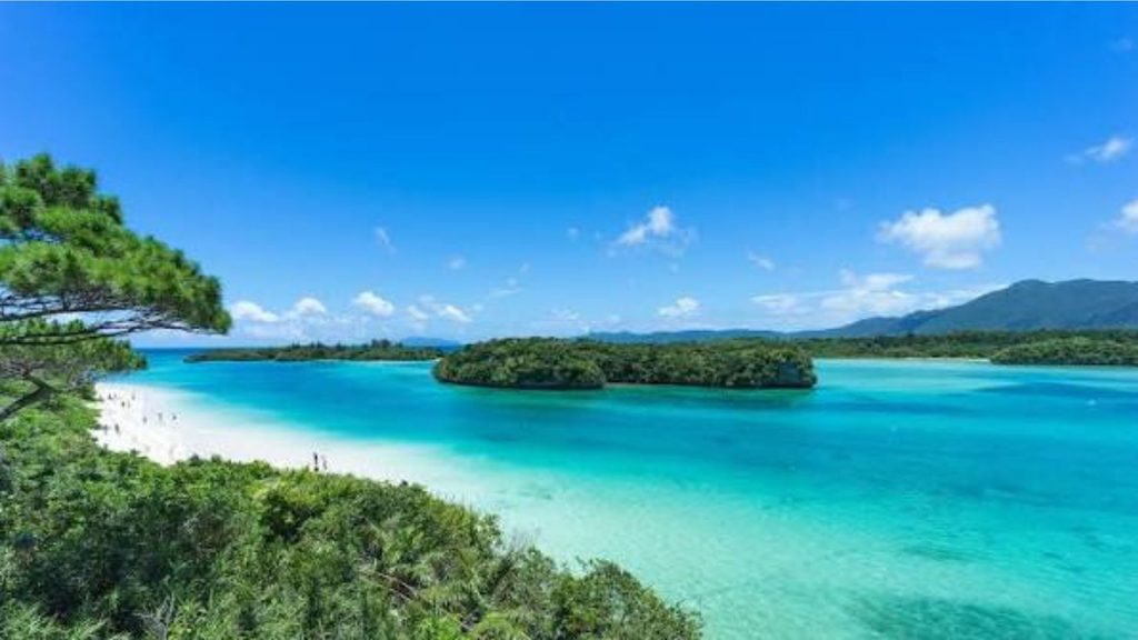
The gateway to the Yaeyama group and a full destination in its own right. Kabira Bay on the northern coast, shallow, sheltered, its turquoise water dotted with small forested islands, its surface broken only by glass-bottom boats since swimming is prohibited due to pearl cultivation and currents, is the most photographed natural formation in the prefecture. The surrounding reef at Manta Scramble, fifteen minutes by boat from the northern coast, is the world’s most reliable manta ray cleaning station. Ishigaki beef, produced from the island’s cattle on the subtropical pastures of the interior, is considered among the finest wagyu beef in Japan.
Ishigaki City, the administrative centre of the Yaeyama group, has the most complete range of restaurants, accommodation, and services available in the island group, the natural overnight base from which every other Yaeyama island is accessible. The Yaeyama Museum in the city covers the history and culture of the island group with more depth than most visitors give it credit for.
Taketomi Island
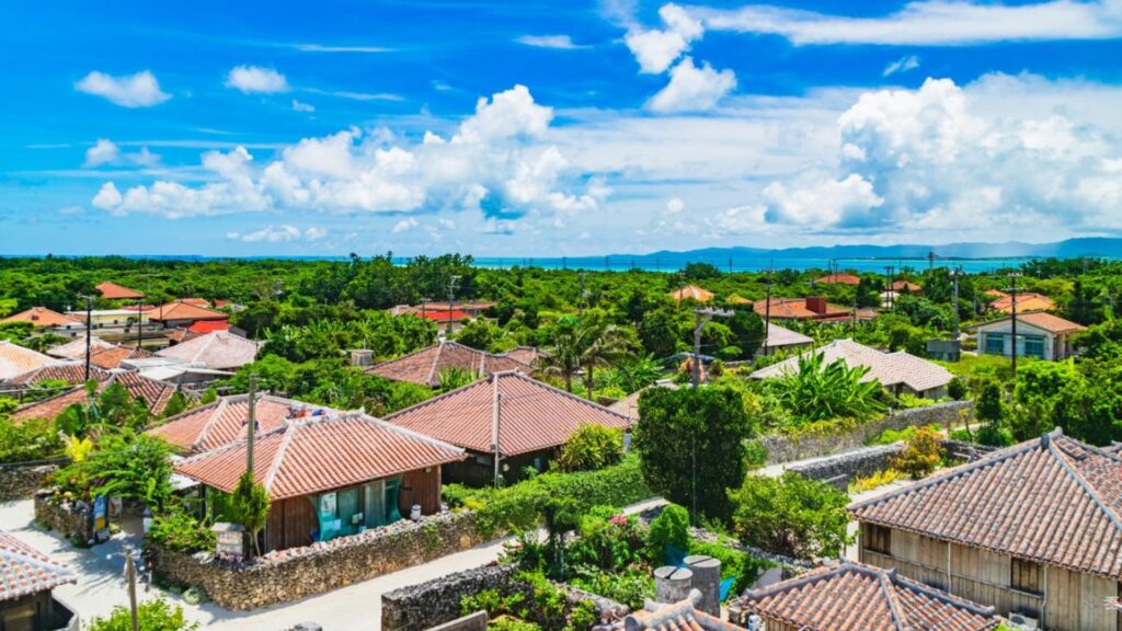
Ten minutes by ferry from Ishigaki, the shortest inter-island crossing in the Yaeyama group. Taketomi is a flat coral island that has preserved its traditional Ryukyuan village in a form unlike anywhere else in the archipelago: low stone walls lining sand-covered lanes, red-tile roofed wooden houses built on raised foundations against the typhoon risk, hibiscus and bougainvillea overflowing the walls, water buffalo carts carrying visitors between the village and the beaches at four kilometres per hour.
The village is genuinely inhabited, approximately 350 permanent residents, most of whom have lived there for generations, and the preservation of its character is the result of community agreement to maintain the traditional building code rather than any top-down heritage designation. New buildings must match the style of the existing ones. The result is the most coherent surviving example of Ryukyuan domestic architecture in the archipelago.
Kondoi Beach on the island’s western coast is the main swimming beach, sheltered, sandy, shallow, with clear reef accessible from the shore. Kaiji Beach to the north has the famous star-shaped sand, tiny, five-pointed grains that are the exoskeletons of foraminifera, visible to the naked eye if you look carefully and worth the ten minutes of examination they require.
The bicycle is the correct transport for Taketomi. Rental is available at the ferry port for approximately 300 yen per hour. The island is small enough to cycle fully in two hours.
Iriomote Island
The most wild and the most extraordinary island in the Yaeyama group. Iriomote is a large island, the second largest in the Okinawa archipelago after the main island, and 90 percent of its surface is subtropical jungle designated as a UNESCO World Natural Heritage Site in 2021. The human population is approximately 2,500. The Iriomote cat, a subspecies of leopard cat found nowhere else on earth, one of the world’s rarest wild cats, lives in the forest interior. The island has no roads crossing its interior; the single road follows the coastline for part of the northern perimeter.
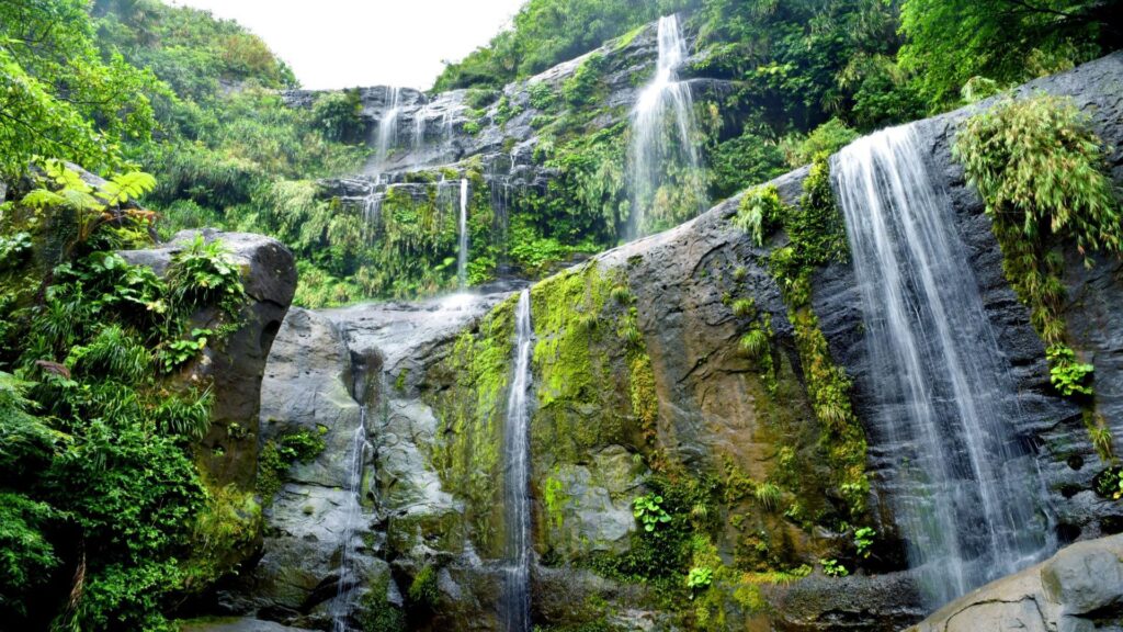
The rivers are the entry point into the jungle. The Urauchi River, the longest river in Okinawa, flows from the island’s mountainous interior to the coast through mangrove forest of extraordinary density, navigable by kayak from the river mouth, with the canopy closing overhead and the sound of the jungle replacing the sound of the sea. The Pinaisara Waterfall, Okinawa’s tallest waterfall at 55 metres, is accessible from the Urauchi River by a combination of kayak and trekking, kayaking upriver, then hiking through the jungle to the waterfall, swimming in the pool at its base, and climbing to the viewpoint above for one of the finest views available in the Yaeyama group.
The coastal reef around Iriomote, less visited than Ishigaki’s dive sites, has encounters with sea turtles, manta rays, and tropical fish in conditions that feel genuinely remote rather than managed. The coral health around the island’s less accessible western coast is among the finest in the prefecture.
Getting to Iriomote requires a 35 to 45-minute ferry from Ishigaki to either Ohara Port in the south or Uehara Port in the north, followed by a hotel shuttle or local bus. Most of the island’s guided activities depart from one of these two ports. The Hoshino Resorts Iriomote Hotel on the north coast handles all logistics for guests and is the most practical base for accessing the guided nature programme.
Hateruma Island
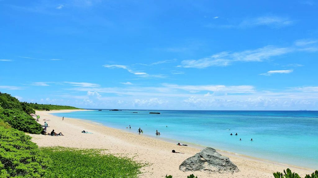
The southernmost inhabited island in Japan. No flights, two ferries per week from Ishigaki (two hours each way, sea conditions permitting), a population of approximately 450, one small guesthouse cluster, and the darkest skies available anywhere in Japan, Hateruma’s absence of light pollution in every direction produces stargazing conditions that are, on a clear night, among the finest accessible from Japanese soil.
The Southern Cross is visible from Hateruma between January and June, providing the only opportunity in Japan to observe the constellation. The Hoshizuna Beach on the island’s north coast has the star-shaped foraminifera sand in quantities that dwarf the small patches available at Kaiji Beach on Taketomi. The reef surrounding the island is the least-dived in the Yaeyama group and correspondingly pristine.
Getting here is not straightforward. The ferry from Ishigaki is subject to frequent cancellation due to sea conditions, the route crosses open water between islands with no shelter from the Pacific swell. Build flexibility into any itinerary that includes Hateruma. The difficulty of access is the reason the island remains as it is.
Yonaguni Island – Japan’s westernmost point
Access: 75-minute flight from Naha, or 4.5-hour ferry from Ishigaki (two departures per week, rough seas common).
Yonaguni is the final island before Taiwan. It sits at the southwestern extreme of the Japanese archipelago, closer to Taipei than to mainland Japan, and it has the feeling of a place that exists at the edge of something: the edge of Japan, the edge of the known, the edge of what has been settled and explained and made comprehensible.

The island has approximately 1,700 inhabitants, three flights per day from Ishigaki and one from Naha, a small airport, a handful of guesthouses, and one of the most significant unresolved questions in underwater archaeology sitting 100 metres off its southern coast.
The Yonaguni Monument
In 1986, a local diving tour operator named Kihachiro Aratake was scouting for a good location to observe hammerhead sharks, for which Yonaguni’s winter waters are famous, when he noticed something on the sea floor that did not look natural. What he found was a structure of sandstone measuring approximately 150 metres in length, 40 metres in width, and 27 metres in height, featuring sharp edges, flat surfaces, what appear to be staircases, terraces, and platforms, a triangular formation that has been compared to a pyramid, and groove-like channels cut with a precision that erosion does not readily explain.
The debate over whether the Yonaguni Monument is natural or man-made has continued without resolution since the discovery. Marine geologist Masaaki Kimura of the University of the Ryukyus, who has made over 100 dives on the site, argues that the formations are man-made stepped monoliths, part of a structure that, if built above sea level, would date to approximately 8,000 to 10,000 years ago, when rising post-glacial sea levels would have submerged the feature. He cites the sharp right angles, the consistent step patterns, and what he interprets as carved features including a turtle formation, a star-shaped platform, and a triangular arch.
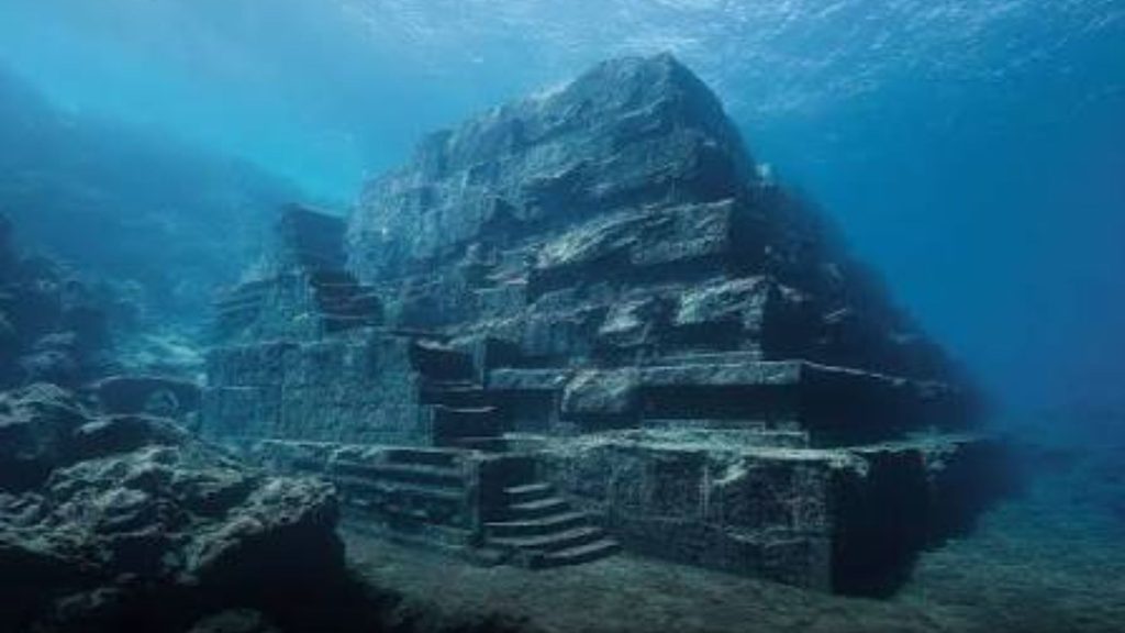
Opposing researchers argue the formations are the product of natural geological processes, the sandstone in this area fractures along horizontal and vertical planes due to its composition, producing the flat surfaces and right angles that suggest human intervention. The Japanese Agency for Cultural Affairs and the Okinawa Prefectural Government have not designated the site as an important cultural artifact and no official archaeological research or preservation work has been undertaken.
Neither position has definitively closed the argument. The BBC has covered the mystery. Academic papers continue to be published on both sides. Divers continue to descend and come up divided.
What is not in dispute: the Yonaguni Monument is a dive site of extraordinary impact. The scale of the formations, you descend to the main terrace and the structure rises above you in both directions, the sharp edges and flat surfaces more precise than instinct says natural rock should be, produces a cognitive dissonance that is unlike any other diving experience available. The currents are strong and an experienced guide is essential. The visibility is typically excellent in winter, when the hammerhead sharks are also present in the water around the monument.
The dive is accessible to certified open-water divers through local operators including Sou-Wes Diving Service, which has been running monument dives since the site’s discovery and whose guides have an unmatched knowledge of the formations. The winter season (November to March) is the recommended diving period, the hammerheads are present in numbers during this window, and the current patterns at the monument are most predictable.
For snorkellers or those who want to observe without diving, the monument’s shallowest section is accessible in calm conditions at approximately five to eight metres depth.
Above the water on Yonaguni
The island itself is worth more than a day. The western cliffs, sheer volcanic rock dropping to the Pacific, accessible by road and by trail, have some of the finest sunset views available in the Okinawa archipelago. The Tindabana cape, on the island’s east coast, provides views across to Iriomote and the Yaeyama Islands in conditions clear enough to see 70 kilometres. Wild horses roam the island’s central plateau, a small population that has been present for generations and is one of the more unexpected details of Yonaguni’s character. The island is also, during the winter months, one of the finest places in Japan to see hammerhead sharks from the surface: the sharks are present in the waters around the eastern point in such numbers that they are sometimes visible from the clifftops.
Island hopping: how to plan it
The outer islands of Okinawa are best approached as a sequence rather than a day-trip circuit. The distances are too significant for comfortable day-tripping from Naha to more than the Keramas, and the quality of each group rewards overnight stays that a day trip cannot deliver.
A suggested outer island sequence for 10 days beyond the main island:
Days 1-2: Zamami Island, Kerama group. Furuzamami Beach, sea turtle snorkelling, overnight guesthouse. January to March: humpback whale watching.
Days 3-4: Miyako Island. Yonaha Maehama, Sunayama Beach, Irabu Island diving, Kurima Island cycling.
Days 5-7: Ishigaki Island. Kabira Bay, Manta Scramble diving, Ishigaki beef dinner, day trip to Taketomi.
Days 8-9: Iriomote Island. Overnight at Hoshino Resorts Iriomote Hotel. Urauchi River kayaking, Pinaisara Waterfall hike, coastal reef snorkelling.
Day 10: Yonaguni Island. Monument dive, western cliffs, hammerheads. Return via Ishigaki to Naha for departure.
What to know about logistics: Each island group requires a separate internal flight or ferry from Naha or from the nearest hub island. The Kerama Islands are the only group accessible by day-trip ferry from Naha. Miyako and Ishigaki are both served by direct flights from Naha, Tokyo, and Osaka. Yonaguni is reached by flight from Ishigaki (most practical) or from Naha. Hateruma is ferry-only from Ishigaki, two departures per week, subject to cancellation.
Book ferry tickets in advance during peak season (July to August), the Kerama high-speed ferries in particular sell out days to weeks ahead. During typhoon season (August to October) build flexibility into outer island itineraries; ferries suspend in typhoon conditions and small island airstrips close in high winds.
The complete Okinawa series
Everything you need to go properly:
- Okinawa: the complete guide – what it is, where it is, the history, the Blue Zone, the full 10-day itinerary
- The beaches and waters of Okinawa – Kerama Blue, Miyako’s finest beach in Japan, Ishigaki’s manta rays, the Blue Cave
- Eating in Okinawa – champuru, soba, sea grapes, awamori, the longevity diet and where to experience it
- Where to stay in Okinawa – Hyakuna Garan’s Michelin Key clifftop ryokan to Kerama Island guesthouses
- The outer islands: Kerama, Miyako and Yaeyama – the islands beyond the main island that reward the traveller willing to take an additional flight
- Why Okinawa is the most extraordinary island group in Asia – the editorial case
Some links in this post are affiliate links. If you book through them, flight.now earns a small commission at no extra cost to you. Learn more here